
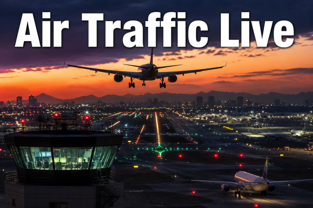
✈️ Full Guide: Air Traffic Live (Real-Time Flight Tracking)
The invisible sky becomes visible — live global aircraft tracking explained
🌍 INTRODUCTION — THE SKY THAT NEVER STOPS MOVING
If you look up at the sky right now, it might feel quiet and empty. But in reality, it is one of the busiest networks on Earth. Thousands of airplanes are flying above us at this very moment — crossing countries, oceans, and continents in perfectly organized routes.
Some are carrying passengers going on holiday. Others are transporting cargo, medicine, or essential supplies. Some are flying overnight routes while others are preparing to land at busy international airports.
Yet from the ground, none of this is visible.
This is where Air Traffic Live (Real-Time Flight Tracking) changes everything. It transforms the invisible sky into a live digital map — showing every aircraft in motion across the world in real time.
🌌 A STORY FROM THE SKY
It is late at night in one part of the world, while in another, the sun is just rising over a busy airport runway.
Somewhere above the Atlantic Ocean, a long-haul aircraft is cruising at 35,000 feet, silently crossing thousands of kilometers. Inside, passengers are asleep, unaware of the vast ocean below them.
At the same time, a cargo plane is leaving Asia, climbing into the night sky carrying goods that will be delivered across continents. In Europe, another aircraft is adjusting its route slightly to avoid storm clouds.
From the ground, all of this is invisible. But on a live flight map, the entire world comes alive.
Tiny moving dots appear on the screen — each one representing a real aircraft, a real journey, and real human movement across the planet.
The sky is no longer empty. It is alive, connected, and constantly moving.
—🛰️ HOW AIR TRAFFIC LIVE WORKS
1. ADS-B (Automatic Dependent Surveillance–Broadcast)
Aircraft constantly broadcast signals containing GPS position, speed, altitude, and identity. These signals are received by ground stations and displayed on live maps.
2. Satellite Tracking
When planes fly over oceans or remote regions, satellites capture their signals to continue tracking them globally.
3. Radar & Airline Systems
Air traffic control radar and airline databases provide additional data such as gate information, delays, and flight schedules.
—✈️ BEST AIR TRAFFIC LIVE TRACKING WEBSITES
- Flightradar24 — Global real-time flight tracking map
- FlightAware — Flight status and delay monitoring
- ADS-B Exchange — Unfiltered live aircraft data
- RadarBox — Aviation analytics and tracking
- OpenSky Network — Research aviation data platform
📱 MOBILE APPS
- Flightradar24 App
- FlightAware App
- Plane Finder
- RadarBox App
🌐 WHY AIR TRAFFIC LIVE IS IMPORTANT
Air Traffic Live is used worldwide for different purposes:
- ✈️ Travelers tracking delays and arrivals
- 👨👩👧 Families monitoring flights of loved ones
- 📸 Aviation enthusiasts spotting aircraft
- 🧠 Students learning about aviation systems
⚠️ LIMITATIONS
- Some military flights are not visible
- Small aircraft may not appear on maps
- Ocean tracking depends on satellites
- Data may have slight delays of a few seconds
🧠 PRO TIPS
- Use multiple trackers for better accuracy
- Try AR mode in mobile apps
- Watch peak flight traffic hours (morning & evening waves)
❓ FREQUENTLY ASKED QUESTIONS (FAQ)
1. What is Air Traffic Live?
A real-time system that shows aircraft movement worldwide on a digital map.
2. Is flight tracking free?
Yes, most platforms offer free versions.
3. How does it work?
It uses ADS-B signals, radar systems, and satellite tracking.
4. Can I track any flight?
Most commercial flights are visible, but not all military or private jets appear.
5. Why are some planes missing?
They may have tracking disabled or be outside coverage areas.
6. Is it accurate?
Yes, especially for commercial aviation.
7. Does it work over oceans?
Yes, using satellite tracking systems.
8. Can I track my own flight?
Yes, by entering your flight number.
9. Is there a delay?
Usually only a few seconds.